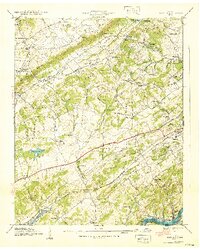
1940 Map of Bearden
USGS Topo · Published 1940About this map
Blackoak Ridge and Hinds Ridge dominate this topography of western Knox County, where the Tennessee Valley Authority and USGS documented the landscape just as the Fort Loudoun Reservoir was being planned. The Southern Railway corridor serves as a primary axis, connecting settlements like Bearden, Byington, and Amherst. This era captures a transition from rural agricultural land to early suburban expansion, evidenced by the clustered residential names like Westmoreland Heights and Meadowbrook.
Find a feature on this map
67 named features on this map. Tap any name to fly to it.
Don’t see what you’re looking for? This feature index may not catch every label — zoom into the map to look around manually.
Map Details
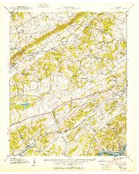
Editions of this 1940 Bearden Map
2 editions found
Other maps of this area

1886 · Knoxville
USGS Topo · 1:125,000

1892 · Knoxville
USGS Topo · 1:125,000

1893 · Briceville
USGS Topo · 1:125,000

1894 · Knoxville
USGS Topo · 1:125,000

1895 · Loudon
USGS Topo · 1:125,000

1895 · Briceville
USGS Topo · 1:125,000

1895 · Knoxville
USGS Topo · 1:125,000

1896 · Briceville
USGS Topo · 1:125,000

1897 · Maynardville
USGS Topo · 1:125,000

1900 · Maynardville
USGS Topo · 1:125,000