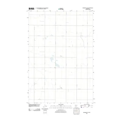
2010 Map of Beardsley NE
USGS Topo · Published 2010About this map
Zion Cemetery and Siloah Cemetery stand as quiet landmarks within this rural expanse of Traverse County. The landscape is defined by a strictly organized grid of agricultural roads, including 630th Ave and 560th St, which trace the section lines of the Minnesota prairie. This late-twentieth-century digital survey illustrates the persistent township-and-range structure that has governed the region's land use for generations. The drainage patterns and small scattered wetlands, visible near County Hwy-5, suggest a terrain that remains largely dedicated to large-scale farming. Connectivity is maintained through a network of regional thoroughfares like County Hwy-6 and County Hwy-4, which link the isolated farmsteads and rural burial grounds that anchor the local community.
Find a feature on this map
20 named features on this map. Tap any name to fly to it.
Don’t see what you’re looking for? This feature index may not catch every label — zoom into the map to look around manually.
Map Details
Editions of this 2010 Beardsley NE Map
This is the sole edition of this map. No revisions or reprints were ever made.
Other maps of this area

1915 · White Rock
USGS Topo · 1:62,500

1916 · Beardsley
USGS Topo · 1:62,500

1918 · White Rock
USGS Topo · 1:62,500

1918 · Beardsley
USGS Topo · 1:62,500

1950 · Graceville
USGS Topo · 1:62,500

1951 · Wheaton
USGS Topo · 1:62,500

1953 · Milbank
USGS Topo · 1:250,000

1958 · Milbank
USGS Topo · 1:250,000
1972 · Rosholt
USGS Topo · 1:24,000
1972 · Wheaton West
USGS Topo · 1:24,000