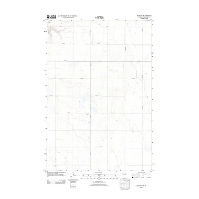
2013 Map of Beardsley NE
USGS Topo · Published 2013About this map
The agricultural landscape of Traverse County unfolds across this 2013 survey, defined by a rigid section-line grid of rural roads and isolated landmarks. The northern reaches are bounded by 610th St, while the primary north-south artery of Co Hwy-5 bisects the terrain. This map captures the quiet continuity of the Minnesota prairie, where the primary indicators of community identity are centered around historic burial grounds. Researchers will find Zion Cem located just west of the highway intersection at 560th St, and Siloah Cem situated further south near the intersection with 570th St. The absence of dense town clusters emphasizes the enduring rural character of this region, governed by the geometry of county routes like Co Hwy-6 and the vast open fields they serve.
Find a feature on this map
11 named features on this map. Tap any name to fly to it.
Don’t see what you’re looking for? This feature index may not catch every label — zoom into the map to look around manually.
Map Details
Editions of this 2013 Beardsley NE Map
This is the sole edition of this map. No revisions or reprints were ever made.
Other maps of this area

1915 · White Rock
USGS Topo · 1:62,500

1916 · Beardsley
USGS Topo · 1:62,500

1918 · White Rock
USGS Topo · 1:62,500

1918 · Beardsley
USGS Topo · 1:62,500

1950 · Graceville
USGS Topo · 1:62,500

1951 · Wheaton
USGS Topo · 1:62,500

1953 · Milbank
USGS Topo · 1:250,000

1958 · Milbank
USGS Topo · 1:250,000
1972 · Rosholt
USGS Topo · 1:24,000
1972 · Wheaton West
USGS Topo · 1:24,000