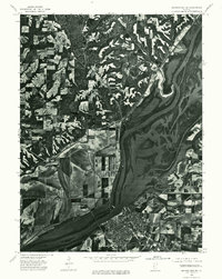
1975 Map of Beardstown SW
USGS Topo · Published 1976About this map
Beardstown anchors the southern landscape where the Sangamon River meets the larger Illinois River corridor. This orthophotograph, derived from 1975 aerial photography, reveals the stark contrast between the dense grid of the river town and the expansive agricultural bottomlands that dominate the floodplain. To the northwest, the settlement of Pleasant View sits on higher ground, overlooking the intricate network of drainage and timbered bluffs. The imagery provides an unfiltered view of mid-1970s land use, capturing the specific field patterns and river morphology of this central Illinois junction before modern development altered the rural and riparian fringes.
Find a feature on this map
4 named features on this map. Tap any name to fly to it.
Don’t see what you’re looking for? This feature index may not catch every label — zoom into the map to look around manually.
Map Details
Editions of this 1975 Beardstown SW Map
This is the sole edition of this map. No revisions or reprints were ever made.
Other maps of this area

1923 · Rushville
USGS Topo · 1:62,500

1926 · Beardstown
USGS Topo · 1:62,500

1926 · Rushville
USGS Topo · 1:62,500

1928 · Meredosia
USGS Topo · 1:62,500

1929 · Arenzville
USGS Topo · 1:62,500

1931 · Meredosia
USGS Topo · 1:62,500

1932 · Arenzville
USGS Topo · 1:62,500

1944 · Beardstown
USGS Topo · 1:62,500

1948 · Quincy
USGS Topo · 1:250,000

1956 · Quincy
USGS Topo · 1:250,000