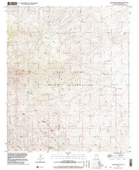
1997 Map of Beargrass Basin
USGS Topo · Published 2002About this map
San Carlos Indian Reservation land dominates this high-elevation terrain, where complex drainage networks like Brushy Wash and Goodwin Canyon cut through the landscape. The geography is defined by its water sources, many of which supported early camps and seasonal activity. Historically significant markers like the Old Indian Treaty Boundary run across the northern section, crossing through the prominent Beargrass Basin. Small-scale evidence of human settlement and resource exploration is scattered throughout the canyons, including a Prospect near Mine Canyon and the site of Dutch Cabin Spring. These named springs, including Fiddler Camp Spring and Wolk Spring, provided the essential infrastructure for movement through this arid Arizona territory, connecting remote outposts such as Goat Camp and Lower Goat Camp.
Find a feature on this map
30 named features on this map. Tap any name to fly to it.
Don’t see what you’re looking for? This feature index may not catch every label — zoom into the map to look around manually.
Map Details
Editions of this 1997 Beargrass Basin Map
This is the sole edition of this map. No revisions or reprints were ever made.
Other maps of this area

1938 · Klondyke
USGS Topo · 1:48,000

1943 · Klondyke
USGS Topo · 1:62,500

1944 · Jackson Mtn.
USGS Topo · 1:62,500

1946 · Jackson Mtn.
USGS Topo · 1:62,500

1954 · Mesa
USGS Topo · 1:250,000

1956 · Tucson
USGS Topo · 1:250,000

1957 · Mesa
USGS Topo · 1:250,000

1958 · Mesa
USGS Topo · 1:250,000

1958 · Tucson
USGS Topo · 1:250,000

1959 · Tucson
USGS Topo · 1:250,000