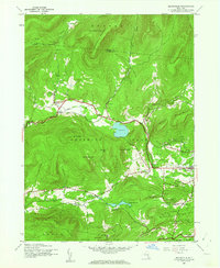
1945 Map of Bearsville
USGS Topo · Published 1962About this map
Catskill Park defines the high-elevation landscape of this mid-century survey, with the Woodstock township serving as a cultural and residential hub in the valley. The map documents a traditional rural infrastructure of numbered school districts, such as School No 5 near Lake Hill and School No 3 south of Bearsville. These points of assembly, along with the settlement at Byrdcliffe, reflect the established community patterns before modern suburban expansion.
Find a feature on this map
43 named features on this map. Tap any name to fly to it.
Don’t see what you’re looking for? This feature index may not catch every label — zoom into the map to look around manually.
Map Details
Editions of this 1945 Bearsville Map
Other maps of this area

1892 · Kaaterskill
USGS Topo · 1:62,500

1893 · Kaaterskill
USGS Topo · 1:62,500

1894 · Kaaterskill
USGS Topo · 1:62,500

1899 · Kaaterskill
USGS Topo · 1:62,500

1900 · Phoenicia
USGS Topo · 1:62,500

1901 · Rosendale
USGS Topo · 1:62,500

1903 · Rosendale
USGS Topo · 1:62,500

1903 · Phoenicia
USGS Topo · 1:62,500

1903 · Kaaterskill
USGS Topo · 1:62,500

1903 · Slide Mountain
USGS Topo · 1:62,500