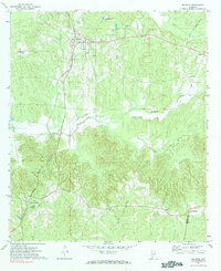
1971 Map of Beatrice
USGS Topo · Published 1984About this map
Beatrice serves as the primary junction for the Louisville and Nashville railroad, which curves through the western portion of this survey. The landscape is defined by the rural crossroads of Monroe County, where small communities like Pineville and Turnbull are connected by winding creeks and country roads. To the south, the settlement of Tunnel Springs anchors the area near Greer Jr High Sch, reflecting the importance of education and rail access in this part of Alabama.
Find a feature on this map
16 named features on this map. Tap any name to fly to it.
Don’t see what you’re looking for? This feature index may not catch every label — zoom into the map to look around manually.
Map Details
Editions of this 1971 Beatrice Map
2 editions found
Other maps of this area

1953 · Andalusia
USGS Topo · 1:250,000

1957 · Andalusia
USGS Topo · 1:250,000

1967 · Beatrice
USGS Topo · 1:24,000

1971 · Skinnerton
USGS Topo · 1:24,000

1971 · China
USGS Topo · 1:24,000

1971 · Burnt Corn
USGS Topo · 1:24,000

1971 · Beatrice
USGS Topo · 1:24,000

1972 · Monroeville
USGS Topo · 1:24,000

1972 · Natchez
USGS Topo · 1:24,000

1973 · Vredenburgh
USGS Topo · 1:24,000