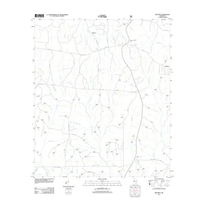
2012 Map of Beatrice
USGS Topo · Published 2012About this map
Beatrice and Dantzler define the rural character of this Jackson County landscape, where the traditional transport network of Wire Rd E meets a complex system of local drainage. The map reveals a heavily wooded interior dissected by numerous branches and creeks, including Tuxachanie Cr and the multi-pronged Hurricane Cr. This 2012 survey illustrates the persistence of early family and community markers through the inclusion of the Broadus Cem, Ramsey Cem, and Walker Cem. A notable landmark, the University Lookout Tower, stands as a vertical focal point near the crossing of Little Red Cr. The inclusion of Old Ccc Rd and various forestry routes suggests a history of land management and infrastructure development that spans from the early 20th century into the modern era.
Find a feature on this map
47 named features on this map. Tap any name to fly to it.
Don’t see what you’re looking for? This feature index may not catch every label — zoom into the map to look around manually.
Map Details
Editions of this 2012 Beatrice Map
This is the sole edition of this map. No revisions or reprints were ever made.
Other maps of this area

1947 · Wiggins
USGS Topo · 1:62,500

1947 · Benndale
USGS Topo · 1:62,500

1949 · Wiggins
USGS Topo · 1:62,500

1949 · Benndale
USGS Topo · 1:62,500

1953 · Mobile
USGS Topo · 1:250,000

1954 · Vestry
USGS Topo · 1:62,500

1954 · McHenry
USGS Topo · 1:62,500

1957 · Mobile
USGS Topo · 1:250,000

1960 · Mobile
USGS Topo · 1:250,000

1963 · Mobile
USGS Topo · 1:250,000