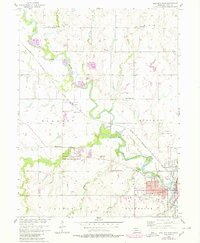
1957 Map of Beatrice West
USGS Topo · Published 1980About this map
The Big Blue River anchors this landscape as it meanders through Gage County, Nebraska, where the homesteading era's legacy remains central to the region. At the bend of Cub Creek, the Homestead National Monument of America marks the site of one of the nation's first land claims, featuring a foot trail through the historic prairie landscape. The map captures a high density of rural schoolhouses, including Freeman Sch, Lonesome Ridge Sch, and Caldwell Sch, which speak to the distributed farmstead settlement patterns of the mid-20th century.
Find a feature on this map
35 named features on this map. Tap any name to fly to it.
Don’t see what you’re looking for? This feature index may not catch every label — zoom into the map to look around manually.
Map Details
Editions of this 1957 Beatrice West Map
2 editions found
Other maps of this area

1955 · Lincoln
USGS Topo · 1:250,000

1957 · Lincoln
USGS Topo · 1:250,000

1957 · Plymouth
USGS Topo · 1:24,000

1957 · Clatonia
USGS Topo · 1:24,000

1957 · Beatrice West
USGS Topo · 1:24,000

1957 · Wilber
USGS Topo · 1:24,000

1957 · Beatrice East
USGS Topo · 1:24,000

1958 · Lincoln
USGS Topo · 1:250,000

1964 · Pickrell
USGS Topo · 1:24,000

1964 · Blue Springs
USGS Topo · 1:24,000