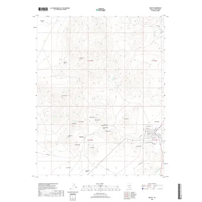
2018 Map of Beatty
USGS Topo · Published 2018About this map
Rhyolite stands as a prominent focal point in this high-desert landscape, situated between the slopes of Sutherland Mtn and Ladd Mtn. The terrain is defined by dramatic elevation changes, with the Bullfrog Hills and Sawtooth Mtn rising above the floor of the Mojave Desert. This 2018 survey reveals a complex hydrological network of springs essential to life in the arid Great Basin, including Upper Indian Spring, Middle Indian Spring, and Lower Indian Springs. In the eastern portion of the map, the Amargosa River flows through the Oasis Valley, while the residential grid of Beatty is clearly delineated with streets like Main St and Montgomery St. The presence of the Desert Hill Cem and numerous named peaks such as Busch Peak and Velvet Peak provides significant geographic context for local researchers and hikers.
Find a feature on this map
55 named features on this map. Tap any name to fly to it.
Don’t see what you’re looking for? This feature index may not catch every label — zoom into the map to look around manually.
Map Details
Editions of this 2018 Beatty Map
This is the sole edition of this map. No revisions or reprints were ever made.
Other maps of this area

1908 · Kawich
USGS Topo · 1:250,000

1908 · Furnace Creek
USGS Topo · 1:250,000

1910 · Furnace Creek
USGS Topo · 1:250,000

1942 · Tolicha Peak
USGS Topo · 1:125,000

1942 · Bullfrog
USGS Topo · 1:125,000

1948 · Death Valley
USGS Topo · 1:250,000

1954 · Bare Mtn
USGS Topo · 1:62,500

1954 · Bullfrog
USGS Topo · 1:62,500

1954 · Death Valley
USGS Topo · 1:250,000

1954 · Goldfield
USGS Topo · 1:250,000