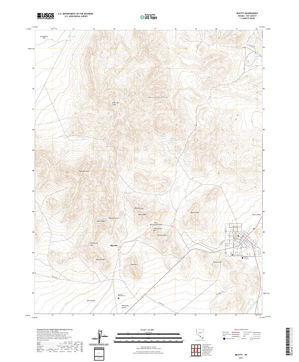
2021 Map of Beatty
USGS Topo · Published 2021About this map
Rhyolite and its neighboring desert heights anchor this 2021 topographic perspective of the Bullfrog Hills. The landscape is defined by its mining heritage and stark isolation, where the Amargosa River flows through the Oasis Valley near the eastern edge of the Mojave Desert. This modern survey details the rugged topography between Sarcobatus Flat and the Amargosa Desert, capturing the transition from the high peaks like Busch Peak to the flat basins below. Local history and genealogy interest is concentrated around the Bullfrog - Rhyolite Cem and the Desert Hill Cem near the town center. The map also records numerous water sources essential to desert survival, including Crystal Springs and the series of Indian springs—Upper, Middle, and Lower—that emerge from the arid slopes of the northern hills.
Find a feature on this map
53 named features on this map. Tap any name to fly to it.
Don’t see what you’re looking for? This feature index may not catch every label — zoom into the map to look around manually.
Map Details
Editions of this 2021 Beatty Map
This is the sole edition of this map. No revisions or reprints were ever made.
Other maps of this area

1908 · Kawich
USGS Topo · 1:250,000

1908 · Furnace Creek
USGS Topo · 1:250,000

1910 · Furnace Creek
USGS Topo · 1:250,000

1942 · Tolicha Peak
USGS Topo · 1:125,000

1942 · Bullfrog
USGS Topo · 1:125,000

1948 · Death Valley
USGS Topo · 1:250,000

1954 · Bare Mtn
USGS Topo · 1:62,500

1954 · Bullfrog
USGS Topo · 1:62,500

1954 · Death Valley
USGS Topo · 1:250,000

1954 · Goldfield
USGS Topo · 1:250,000