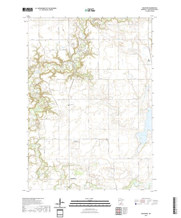
2022 Map of Beauford
USGS Topo · Published 2022About this map
St. Clair and Beauford serve as the primary anchors of this southern Minnesota landscape, where the winding courses of the Le Sueur River and the Cobb River carve through the glacial till. The terrain is marked by the distinct incision of Hungry Hollow and the drainage network of County Ditch Number Eighty-eight, illustrating the conversion of the prairie into a highly productive agricultural grid. For genealogists and local historians, the presence of Decoria Cem and Oak Hill Cem provides vital reference points for tracing early settler families in Blue Earth County. The southern portion of the map includes the Hoppe Sky Ranch Airport, a notable privately-owned landing strip that sits among the rural sections. To the east, the wetland expanse of Rice Lake and the confluence of the Little Cobb River highlight the hydraulic complexity of the watershed, showing the balance between natural water bodies and the engineered drainage systems necessary for regional farming.
Find a feature on this map
79 named features on this map. Tap any name to fly to it.
Don’t see what you’re looking for? This feature index may not catch every label — zoom into the map to look around manually.
Map Details
Editions of this 2022 Beauford Map
This is the sole edition of this map. No revisions or reprints were ever made.
Other maps of this area

1950 · Mankato East
USGS Topo · 1:62,500

1951 · Mankato East
USGS Topo · 1:62,500

1951 · Mankato West
USGS Topo · 1:62,500

1953 · Saint Paul
USGS Topo · 1:250,000

1953 · New Ulm
USGS Topo · 1:250,000

1954 · Fairmont
USGS Topo · 1:250,000

1954 · Mason City
USGS Topo · 1:250,000

1957 · New Ulm
USGS Topo · 1:250,000

1957 · Mason City
USGS Topo · 1:250,000

1958 · New Ulm
USGS Topo · 1:250,000