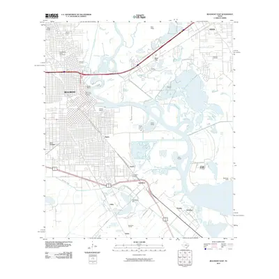
2010 Map of Beaumont East
USGS Topo · Published 2010About this map
The legacy of the Texas oil boom is etched into this 2010 landscape of Beaumont and its eastern industrial corridors. The historic Lucas Gusher Spindletop Oil Field and Spindletop Hill anchor the southern portion of the map, illustrating the continued significance of the petroleum industry near Guffey and McFadden. To the north, the winding Neches River divides the urban center from several large islands, including Smith Island and Clark Island, while the Port Arthur Canal and Union Canal highlight the region's complex water-management and shipping infrastructure.
Find a feature on this map
52 named features on this map. Tap any name to fly to it.
Don’t see what you’re looking for? This feature index may not catch every label — zoom into the map to look around manually.
Map Details
Editions of this 2010 Beaumont East Map
This is the sole edition of this map. No revisions or reprints were ever made.
Other maps of this area

1926 · Terry
USGS Topo · 1:24,000

1926 · Lakeview
USGS Topo · 1:24,000

1926 · Vidor
USGS Topo · 1:24,000

1926 · Texla
USGS Topo · 1:24,000

1932 · Beaumont
USGS Topo · 1:62,500

1943 · Port Arthur North
USGS Topo · 1:24,000

1943 · Terry
USGS Topo · 1:24,000

1943 · Texla
USGS Topo · 1:24,000

1943 · Fannett East
USGS Topo · 1:24,000

1943 · Beaumont East
USGS Topo · 1:24,000