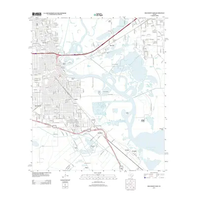
2013 Map of Beaumont East
USGS Topo · Published 2013About this map
Spindletop Hill and the legendary Lucas Gusher Spindletop Oil Field anchor the southern landscape of this 2013 survey, marking the site of the historic Texas oil boom. The map detail highlights the industrial legacy of the region, from the active Rose City Oil Field to the Spindletop Oil Field and Spindletop Springs. These petroleum landmarks are interspersed with early 20th-century settlements like Guffey, Gladys, and McFadden, which grew alongside the burgeoning energy economy.
Find a feature on this map
41 named features on this map. Tap any name to fly to it.
Don’t see what you’re looking for? This feature index may not catch every label — zoom into the map to look around manually.
Map Details
Editions of this 2013 Beaumont East Map
This is the sole edition of this map. No revisions or reprints were ever made.
Other maps of this area

1926 · Terry
USGS Topo · 1:24,000

1926 · Lakeview
USGS Topo · 1:24,000

1926 · Vidor
USGS Topo · 1:24,000

1926 · Texla
USGS Topo · 1:24,000

1932 · Beaumont
USGS Topo · 1:62,500

1943 · Port Arthur North
USGS Topo · 1:24,000

1943 · Terry
USGS Topo · 1:24,000

1943 · Texla
USGS Topo · 1:24,000

1943 · Fannett East
USGS Topo · 1:24,000

1943 · Beaumont East
USGS Topo · 1:24,000