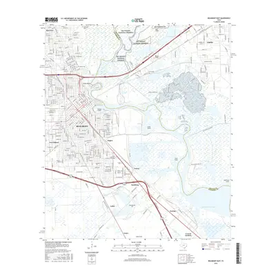
2016 Map of Beaumont East
USGS Topo · Published 2016About this map
Beaumont and the intricate industrial landscape of the Texas Gulf Coast dominate this survey, centered where the Neches River divides Jefferson and Orange counties. The area's legacy as an energy and education hub is evident through landmarks like Spindletop Hill and Lamar University. Urban neighborhoods such as Pine Crest, Higgins, and West Oakland fan out from the river, while the eastern bank is defined by the marshy expanse of Smith Island and Clark Island. The northern reaches of the map show the conservation efforts at Big Thicket National Preserve, contrasting with the heavily engineered waterways of the Union Canal and Port Arthur Canal. Researchers will find a high density of local history markers, including several significant burial grounds like Magnolia Cemetery and Mansfield Cemetery, alongside transit remnants like Old Mansfield Ferry Rd.
Find a feature on this map
39 named features on this map. Tap any name to fly to it.
Don’t see what you’re looking for? This feature index may not catch every label — zoom into the map to look around manually.
Map Details
Editions of this 2016 Beaumont East Map
This is the sole edition of this map. No revisions or reprints were ever made.
Other maps of this area

1926 · Terry
USGS Topo · 1:24,000

1926 · Lakeview
USGS Topo · 1:24,000

1926 · Vidor
USGS Topo · 1:24,000

1926 · Texla
USGS Topo · 1:24,000

1932 · Beaumont
USGS Topo · 1:62,500

1943 · Port Arthur North
USGS Topo · 1:24,000

1943 · Terry
USGS Topo · 1:24,000

1943 · Texla
USGS Topo · 1:24,000

1943 · Fannett East
USGS Topo · 1:24,000

1943 · Beaumont East
USGS Topo · 1:24,000