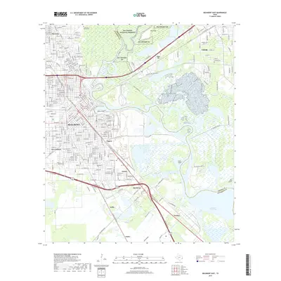
2019 Map of Beaumont East
USGS Topo · Published 2019About this map
The Neches River winds through a complex landscape of coastal waterways and industrial corridors, separating Beaumont in Jefferson County from the neighboring city of Vidor in Orange County. This 2019 survey captures the convergence of the Port Arthur Canal and the Union Canal near the legendary Spindletop oil field area. The terrain transitions from the protected wetlands of the Big Thicket NP and Big Thicket National Preserve to the dense rail and road networks of the Southern Pacific RD. Pockets of local history are preserved in sites like Magnolia Cem and Sullivan Cem, while industrial and residential settlements such as Guffey, Gladys, and Dowling trace the path of the region's historical economic expansion toward the coast.
Find a feature on this map
130 named features on this map. Tap any name to fly to it.
Don’t see what you’re looking for? This feature index may not catch every label — zoom into the map to look around manually.
Map Details
Editions of this 2019 Beaumont East Map
This is the sole edition of this map. No revisions or reprints were ever made.
Other maps of this area

1926 · Terry
USGS Topo · 1:24,000

1926 · Lakeview
USGS Topo · 1:24,000

1926 · Vidor
USGS Topo · 1:24,000

1926 · Texla
USGS Topo · 1:24,000

1932 · Beaumont
USGS Topo · 1:62,500

1943 · Port Arthur North
USGS Topo · 1:24,000

1943 · Terry
USGS Topo · 1:24,000

1943 · Texla
USGS Topo · 1:24,000

1943 · Fannett East
USGS Topo · 1:24,000

1943 · Beaumont East
USGS Topo · 1:24,000