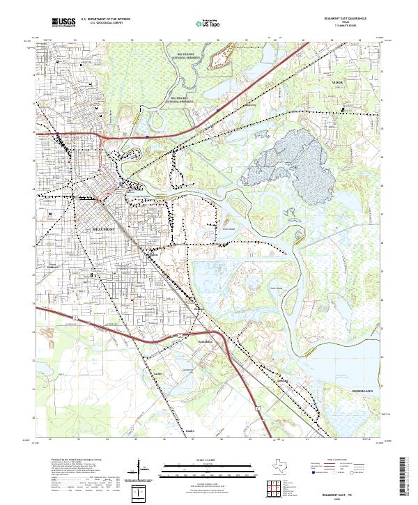
2022 Map of Beaumont East
USGS Topo · Published 2022About this map
The industrial and riparian geography of Southeast Texas is centered here on the Neches River, where the deep-water Port Arthur Canal meets the complex bayous of the coastal plain. The urban sprawl of Beaumont dominates the western half of the sheet, extending from the civic heart at the Jefferson County Courthouse south toward the institutional grounds of Lamar University. The landscape is a study in transition between heavy industry and conservation, with the protected marshlands of the Big Thicket National Preserve and Smith Island contrasting against the infrastructure of the petrochemical corridor. To the south, the name Spindletop Hill and Spindletop Springs mark the site of the world-changing oil discovery, while numerous historic burial grounds like Magnolia Cem and Hebrew Rest Cem provide essential touchstones for local genealogical research in this long-settled river hub.
Find a feature on this map
61 named features on this map. Tap any name to fly to it.
Don’t see what you’re looking for? This feature index may not catch every label — zoom into the map to look around manually.
Map Details
Editions of this 2022 Beaumont East Map
This is the sole edition of this map. No revisions or reprints were ever made.
Other maps of this area

1926 · Terry
USGS Topo · 1:24,000

1926 · Lakeview
USGS Topo · 1:24,000

1926 · Vidor
USGS Topo · 1:24,000

1926 · Texla
USGS Topo · 1:24,000

1932 · Beaumont
USGS Topo · 1:62,500

1943 · Port Arthur North
USGS Topo · 1:24,000

1943 · Terry
USGS Topo · 1:24,000

1943 · Texla
USGS Topo · 1:24,000

1943 · Fannett East
USGS Topo · 1:24,000

1943 · Beaumont East
USGS Topo · 1:24,000