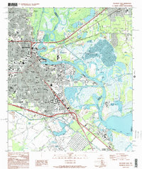
1994 Map of Beaumont East
USGS Topo · Published 1994About this map
The industrial and educational landscape of Southeast Texas is centered here at the Neches River, where the heavy infrastructure of the petroleum era meets the urban growth of Beaumont. The map documents the legendary Spindletop Oil Field and the adjacent settlement of Spindletop, marking the enduring legacy of the Texas oil boom. This energy-driven economy is further evidenced by the Rose City Oil Field and the sprawling petroleum facilities on Harbor Island.
Find a feature on this map
69 named features on this map. Tap any name to fly to it.
Don’t see what you’re looking for? This feature index may not catch every label — zoom into the map to look around manually.
Map Details
Editions of this 1994 Beaumont East Map
This is the sole edition of this map. No revisions or reprints were ever made.
Other maps of this area

1926 · Terry
USGS Topo · 1:24,000

1926 · Lakeview
USGS Topo · 1:24,000

1926 · Vidor
USGS Topo · 1:24,000

1926 · Texla
USGS Topo · 1:24,000

1932 · Beaumont
USGS Topo · 1:62,500

1943 · Port Arthur North
USGS Topo · 1:24,000

1943 · Terry
USGS Topo · 1:24,000

1943 · Texla
USGS Topo · 1:24,000

1943 · Fannett East
USGS Topo · 1:24,000

1943 · Beaumont East
USGS Topo · 1:24,000