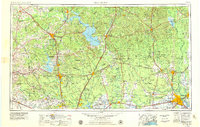
1984 Map of Beaumont
USGS Topo · Published 1984About this map
The Trinity River and Neches River basins define this southeastern Texas landscape, where vast timberlands meet the industrial reach of the Gulf Coast. In the late 1970s and early 1980s, the region was characterized by massive water impoundments like Lake Livingston and Lake Conroe, alongside extensive protected areas such as the Sam Houston National Forest and the Big Thicket National Preserve. Large-scale institutional land use is evident in the cluster of prison facilities near the Trinity River, including the Ferguson State Prison Farm and Eastham State Prison Farm. Transport networks are anchored by the Missouri Pacific and Southern Pacific railroads, which connect hubs like Beaumont and Conroe. The map reveals a transition from the dense piney woods into the oil-rich coastal prairies, with numerous oil fields and wells dotting the landscape between Humble and Sour Lake.
Find a feature on this map
57 named features on this map. Tap any name to fly to it.
Don’t see what you’re looking for? This feature index may not catch every label — zoom into the map to look around manually.
Map Details
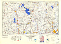
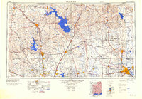
Editions of this 1984 Beaumont Map
3 editions found
Historical Maps of Porter Through Time
5 maps found