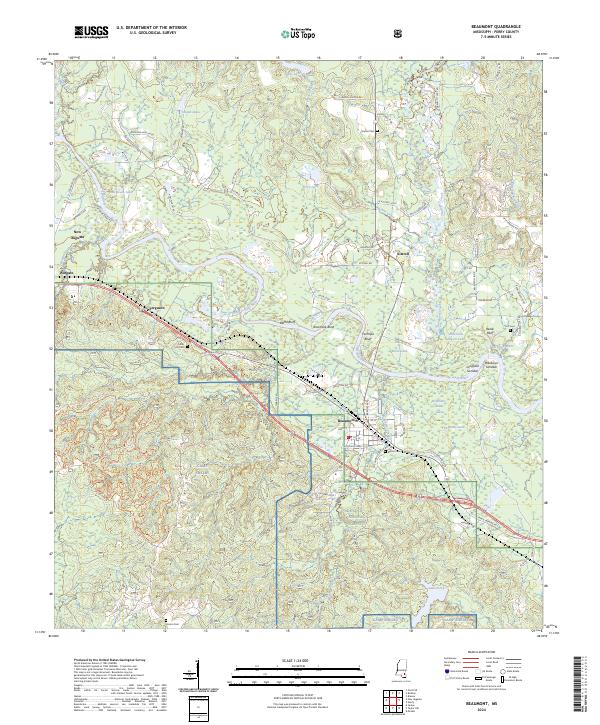
2024 Map of Beaumont
USGS Topo · Published 2024About this map
The Leaf River winds through the heart of Perry County, carving a complex path marked by geographic features like Racetrack Bend and Horseshoe Bend Lake. This modern survey documents the interface between established settlements and the sprawling managed lands of the De Soto National Forest and Camp Shelby. The map reveals a landscape defined by water and forest, where small communities such as New Augusta and Beaumont serve as local hubs connected by a network of rural roads bearing family names like Vardaman Hinton Rd and Willie Jordon Rd.
Find a feature on this map
90 named features on this map. Tap any name to fly to it.
Don’t see what you’re looking for? This feature index may not catch every label — zoom into the map to look around manually.
Map Details
Editions of this 2024 Beaumont Map
This is the sole edition of this map. No revisions or reprints were ever made.
Other maps of this area

1947 · Beaumont
USGS Topo · 1:62,500

1947 · New Augusta
USGS Topo · 1:62,500

1949 · Beaumont
USGS Topo · 1:62,500

1949 · New Augusta
USGS Topo · 1:62,500

1953 · Hattiesburg
USGS Topo · 1:250,000

1958 · Hattiesburg
USGS Topo · 1:250,000

1963 · Brewer
USGS Topo · 1:24,000

1964 · Ovett SE
USGS Topo · 1:24,000

1964 · Richton
USGS Topo · 1:24,000
1982 · Neely
USGS Topo · 1:24,000