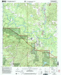
2000 Map of Beaumont
USGS Topo · Published 2003About this map
The Leaf River snakes through the center of this landscape, its path defined by natural landmarks like Bland Bluff, Racetrack Bend, and Fairhope Bluff. Much of the southern and western terrain is occupied by the De Soto National Forest, where the Rattlesnake Bay ATV Trail winds through the woods. The town of Beaumont serves as the primary hub, situated near the confluence of the river and Thompson Creek, an area marked by industrial sandpits and gravel pits.
Find a feature on this map
55 named features on this map. Tap any name to fly to it.
Don’t see what you’re looking for? This feature index may not catch every label — zoom into the map to look around manually.
Map Details
Editions of this 2000 Beaumont Map
This is the sole edition of this map. No revisions or reprints were ever made.
Other maps of this area

1947 · Beaumont
USGS Topo · 1:62,500

1947 · New Augusta
USGS Topo · 1:62,500

1949 · Beaumont
USGS Topo · 1:62,500

1949 · New Augusta
USGS Topo · 1:62,500

1953 · Hattiesburg
USGS Topo · 1:250,000

1958 · Hattiesburg
USGS Topo · 1:250,000

1963 · Brewer
USGS Topo · 1:24,000

1964 · Ovett SE
USGS Topo · 1:24,000

1964 · Richton
USGS Topo · 1:24,000
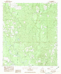
1982 · Neely
USGS Topo · 1:24,000