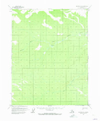
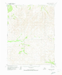
1970 Map of Beaver C-5
USGS Topo · Published 1973About this map
Hodzana River and its tributary Mud Fork dominate this 1970 landscape, winding through a wilderness region of the Yukon-Koyukuk. The geography here is defined by riverine movement and high-latitude terrain, where the water systems provided the primary corridors for travel and subsistence. A small Landing Strip and Caribou Bar on the banks of the Hodzana represent the minimal human footprint at the time of the survey. The mapping reveals a sparse network of natural features rather than settled towns, reflecting the remote interior character of Alaska before modern expansion. This survey was photogrammetrically compiled from aerial photographs, capturing the exact state of the riverbanks and sandbars during the 1970 season.
Find a feature on this map
4 named features on this map. Tap any name to fly to it.
Don’t see what you’re looking for? This feature index may not catch every label — zoom into the map to look around manually.
Map Details
Editions of this 1970 Beaver C-5 Map
This is the sole edition of this map. No revisions or reprints were ever made.
Other maps of this area

1951 · Beaver
USGS Topo · 1:250,000

1956 · Beaver B-5
USGS Topo · 1:63,360

1956 · Beaver
USGS Topo · 1:250,000

1956 · Beaver B-4
USGS Topo · 1:63,360

1964 · Beaver
USGS Topo · 1:250,000
1970 · Beaver D-5
USGS Topo · 1:63,360
1970 · Beaver C-6
USGS Topo · 1:63,360

1970 · Beaver B-6
USGS Topo · 1:63,360
1970 · Beaver D-4
USGS Topo · 1:63,360
1970 · Beaver D-6
USGS Topo · 1:63,360