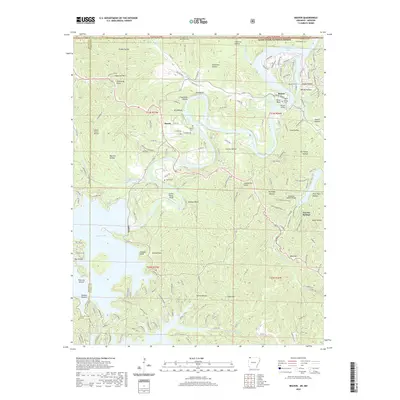
2020 Map of Beaver
USGS Topo · Published 2020About this map
Beaver Lake and the White River watershed dominate this terrain along the Arkansas and Missouri border, where the White River flows north into Table Rock Lake. The town of Beaver serves as a focal point, featuring the notable Beaver Bridge and Beaver Cem, while the community of Busch sits to the west near Walden Cem. High bluffs and steep hollows define the topography, including Salts Bluff and Crane Roost Bluff, which provide dramatic elevation changes above the water. To the east, the landscape transitions toward Eureka Springs and the protected lands of the Mark Twain National Forest. Local history is preserved in small burial grounds like Fuller Cem and geographic markers such as Inspiration Point, reflecting a landscape deeply shaped by its river-driven economy and the creation of major reservoirs.
Find a feature on this map
178 named features on this map. Tap any name to fly to it.
Don’t see what you’re looking for? This feature index may not catch every label — zoom into the map to look around manually.
Map Details
Editions of this 2020 Beaver Map
This is the sole edition of this map. No revisions or reprints were ever made.
Other maps of this area

1900 · Eureka Springs
USGS Topo · 1:125,000

1901 · Eureka Springs
USGS Topo · 1:125,000

1927 · Shell Knob
USGS Topo · 1:62,500

1937 · Cassville
USGS Topo · 1:48,000

1944 · Cassville
USGS Topo · 1:62,500

1945 · Harrison
USGS Topo · 1:250,000

1949 · Harrison
USGS Topo · 1:250,000

1950 · Shell Knob
USGS Topo · 1:62,500

1954 · Harrison
USGS Topo · 1:250,000

1957 · Mundell
USGS Topo · 1:24,000