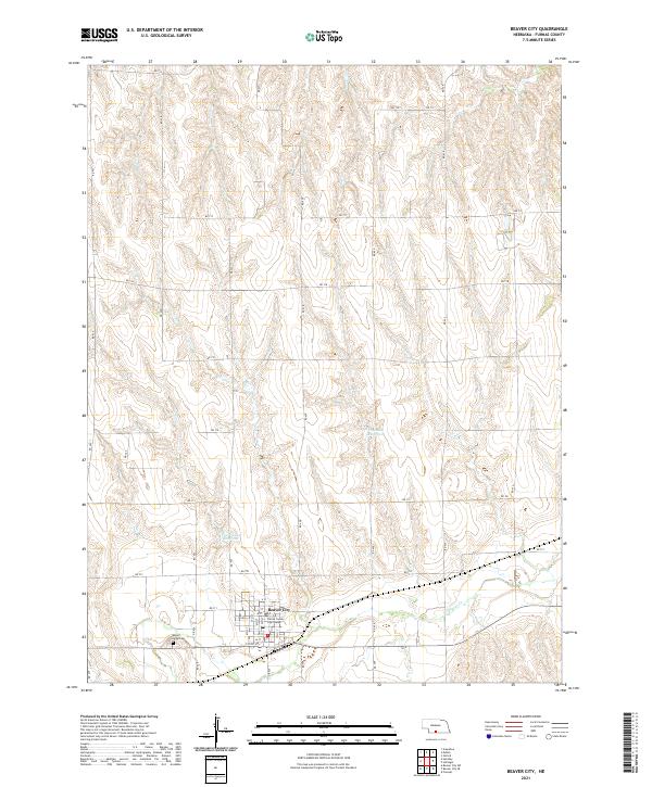
2021 Map of Beaver City
USGS Topo · Published 2021About this map
Beaver City serves as the focal point of this southwestern Nebraska landscape, where the town’s grid is anchored by the Furnas County Courthouse. The surrounding terrain is defined by the drainage of Beaver Cr, which meanders through the southern portion of the quadrangle. Agricultural infrastructure is evident in the presence of the Theobald Reservoir and Van Cleave Reservoir, vital water management features for the high plains. On the western edge of the settlement, Mount Hope Cem provides a point of genealogical interest. The map detail highlights the intersection of the regional road network, including RD 711 and RD 427, which connect the town to the broader county landscape. This modern survey reflects the enduring structure of a Nebraska county seat, where the courthouse square remains the heart of a community shaped by the subtle draws and ridges of the prairie.
Find a feature on this map
41 named features on this map. Tap any name to fly to it.
Don’t see what you’re looking for? This feature index may not catch every label — zoom into the map to look around manually.
Map Details
Editions of this 2021 Beaver City Map
This is the sole edition of this map. No revisions or reprints were ever made.
Other maps of this area

1896 · Arapahoe
USGS Topo · 1:125,000

1898 · Arapahoe
USGS Topo · 1:125,000

1955 · Grand Island
USGS Topo · 1:250,000

1957 · Grand Island
USGS Topo · 1:250,000
1957 · Beaver City SW
USGS Topo · 1:24,000

1957 · Precept
USGS Topo · 1:24,000

1957 · Beaver City SE
USGS Topo · 1:24,000

1958 · Grand Island
USGS Topo · 1:250,000

1958 · Edison
USGS Topo · 1:24,000

1958 · Hollinger
USGS Topo · 1:24,000