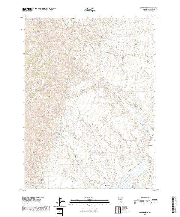
2021 Map of Beaver Creek
USGS Topo · Published 2021About this map
Lake Mtn anchors the northern high ground of this Elko County quadrangle, overlooking a complex network of drainages that define the local ranching landscape. The area is characterized by high-elevation canyons such as Williams Canyon, Toro Canyon, and Barber Canyon, which funnel seasonal waters into larger systems like Beaver Cr and Little Beaver Cr. This 2021 survey illustrates the continued importance of established grazing and agricultural lands, specifically noting named areas like South Field and Taylor Field. The orientation of the Red House Ranch road and the convergence of N Haskell Cr with Haskell Cr reveal the essential connection between water sources and land use in this arid territory. This modern topographic record preserves the precise township and range divisions, such as t37n r51e, providing a clear spatial framework for the remote watersheds of Coyote Cr and Donna Cr.
Find a feature on this map
19 named features on this map. Tap any name to fly to it.
Don’t see what you’re looking for? This feature index may not catch every label — zoom into the map to look around manually.
Map Details
Editions of this 2021 Beaver Creek Map
This is the sole edition of this map. No revisions or reprints were ever made.
Other maps of this area

1955 · McDermitt
USGS Topo · 1:250,000

1955 · Winnemucca
USGS Topo · 1:250,000

1958 · Winnemucca
USGS Topo · 1:250,000

1958 · Blue Basin
USGS Topo · 1:24,000
1958 · Swales Mountain
USGS Topo · 1:24,000

1959 · McDermitt
USGS Topo · 1:250,000

1962 · Winnemucca
USGS Topo · 1:250,000

1968 · Rodeo Creek NE
USGS Topo · 1:24,000

1968 · Swales Mountain NW
USGS Topo · 1:24,000

1970 · Sugarloaf Butte
USGS Topo · 1:24,000