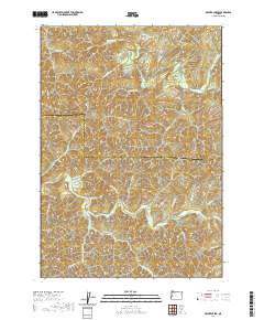
2020 Map of Beaver Creek
USGS Topo · Published 2020About this map
The Siuslaw River and Smith River define this deeply dissected landscape along the border of Lane and Douglas counties. This terrain is characterized by a dense network of drainages and timber access routes, where the primary human footprint is found along the narrow valley corridors. To the north, the Siuslaw River Rd follows its namesake waterway, while the southern portion of the map is dominated by the complex headwaters of the S Fork Smith River. Numerous small tributaries with distinctive local names, such as Fryingpan Cr, Salmonberry Cr, and Arthur Jones Cr, reveal a history of local geographic identification. The presence of the Paradise Protection Rd and various Bureau of Land Management routes like BLM Rd 20-6-4 highlights the importance of forest management and fire protection in this heavily wooded region of the Oregon Coast Range.
Find a feature on this map
42 named features on this map. Tap any name to fly to it.
Don’t see what you’re looking for? This feature index may not catch every label — zoom into the map to look around manually.
Map Details
Editions of this 2020 Beaver Creek Map
This is the sole edition of this map. No revisions or reprints were ever made.
Other maps of this area

1942 · Crow
USGS Topo · 1:62,500

1942 · Roman Nose Mtn
USGS Topo · 1:62,500

1945 · Crow
USGS Topo · 1:62,500

1945 · Roman Nose Mtn
USGS Topo · 1:62,500

1954 · Drain
USGS Topo · 1:62,500

1955 · Elkton
USGS Topo · 1:62,500

1958 · Roseburg
USGS Topo · 1:250,000

1959 · Roseburg
USGS Topo · 1:250,000

1979 · Cottage Grove
USGS Topo · 1:100,000
1984 · High Point
USGS Topo · 1:24,000