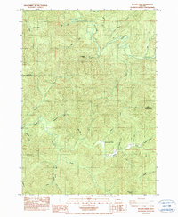
1984 Map of Beaver Creek
USGS Topo · Published 1984About this map
The Suislaw River and Smith River systems dominate this mid-1980s landscape along the border of Lane and Douglas Counties. This mountainous region is defined by an intricate network of drainages, where named features often reflect early local families or colorful descriptive markers, such as Arthur Jones Cr, Fryingpan Creek, and Shitten Creek. Central to the drainage basin is the Beaver Creek School, a lone institutional landmark situated near the confluence of Beaver Creek and the Smith River. The terrain is notably steep, characterized by high ridges like Peterson Point and deep valleys such as Doe Hollow Creek. This provisional survey preserves the geographical nomenclature of the Coast Range timberlands, illustrating the complex hydrology where the South Fork Smith River meets its numerous tributaries like Cleavenger Cr and Plank Creek.
Find a feature on this map
30 named features on this map. Tap any name to fly to it.
Don’t see what you’re looking for? This feature index may not catch every label — zoom into the map to look around manually.
Map Details
Editions of this 1984 Beaver Creek Map
This is the sole edition of this map. No revisions or reprints were ever made.
Other maps of this area

1942 · Crow
USGS Topo · 1:62,500

1942 · Roman Nose Mtn
USGS Topo · 1:62,500

1945 · Crow
USGS Topo · 1:62,500

1945 · Roman Nose Mtn
USGS Topo · 1:62,500

1954 · Drain
USGS Topo · 1:62,500

1955 · Elkton
USGS Topo · 1:62,500

1958 · Roseburg
USGS Topo · 1:250,000

1959 · Roseburg
USGS Topo · 1:250,000

1979 · Cottage Grove
USGS Topo · 1:100,000
1984 · High Point
USGS Topo · 1:24,000