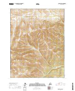
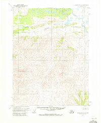
2017 Map of Beaver D-4 NW
USGS Topo · Published 2017About this map
Trail Creek and Trout Creek flow through the northern reaches of this interior Alaskan landscape, defining the drainage patterns of the Yukon-Koyukuk region. In the southeast, Hardpac Creek cuts through the high-elevation terrain, where steep contour intervals reveal a complex system of ridges and valleys. The area is dominated by the Public Land Survey System grid, specifically within townships t25n r7w, t25n r6w, t24n r7w, and t24n r6w. This map captures a pristine wilderness devoid of established roads or settlements, where the geography is shaped entirely by its hydrology and significant elevation changes.
Find a feature on this map
7 named features on this map. Tap any name to fly to it.
Don’t see what you’re looking for? This feature index may not catch every label — zoom into the map to look around manually.
Map Details
Editions of this 2017 Beaver D-4 NW Map
This is the sole edition of this map. No revisions or reprints were ever made.
Other maps of this area

1951 · Chandalar
USGS Topo · 1:250,000

1951 · Beaver
USGS Topo · 1:250,000

1956 · Chandalar
USGS Topo · 1:250,000

1956 · Beaver
USGS Topo · 1:250,000

1964 · Chandalar
USGS Topo · 1:250,000

1964 · Beaver
USGS Topo · 1:250,000
1970 · Beaver D-5
USGS Topo · 1:63,360
1970 · Beaver D-4
USGS Topo · 1:63,360
1970 · Chandalar A-5
USGS Topo · 1:63,360
1970 · Chandalar A-4
USGS Topo · 1:63,360