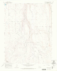
1964 Map of Beaver Park
USGS Topo · Published 1968About this map
The Uncompahgre National Forest dominates this mid-1960s landscape, where high-altitude plateaus like Beaver Mesa drop sharply into the steep drainage of Beaver Canyon. The map reveals a complex water management system essential for this arid high country, featuring the Gurley Ditch, Old Nelson Ditch, and the West Beaver Highline Ditch winding across the contours. Human presence is sparse and functional, marked by seasonal locations such as Taylor Camp and Marie Scott Camp, alongside the Lone Cone Guard Station in the south. The terrain is characterized by the confluence of numerous forks, including East Beaver Creek and Middle Beaver Creek, which gather in the park before flowing north. For those tracing the history of land use in San Miguel County, the map provides exact locations for cattle-era infrastructure like the Beef Trail Road and a Corral near Galloway Creek.
Find a feature on this map
40 named features on this map. Tap any name to fly to it.
Don’t see what you’re looking for? This feature index may not catch every label — zoom into the map to look around manually.
Map Details
Editions of this 1964 Beaver Park Map
2 editions found
Other maps of this area

1953 · Dolores Peak
USGS Topo · 1:24,000

1953 · Placerville
USGS Topo · 1:24,000

1953 · Little Cone
USGS Topo · 1:24,000

1956 · Cortez
USGS Topo · 1:250,000

1956 · Moab
USGS Topo · 1:250,000

1958 · Cortez
USGS Topo · 1:250,000

1959 · Cortez
USGS Topo · 1:250,000

1959 · Moab
USGS Topo · 1:250,000

1960 · Moab
USGS Topo · 1:250,000

1962 · Moab
USGS Topo · 1:250,000