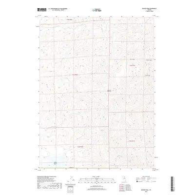
2018 Map of Beaver Peak
USGS Topo · Published 2018About this map
The high ridges of the Tuscarora Mountains dominate this high-desert landscape in northern Nevada, where the terrain rises sharply to the summit of Beaver Peak. This remote portion of Elko County is characterized by its drainage systems, including Coyote Cr and the branching pathways of Toro Canyon and Barber Canyon. To the southwest, the topography transitions toward the Little Boulder Basin, a distinct geographical depression. The map illustrates a largely uninhabited expanse defined by the Public Land Survey System grid, including portions of t37n r51e, where the primary features are the natural watercourses like Bell Cr and the complex contouring of the mountain range. This survey provides a clear view of the drainage patterns and elevation changes that define this rugged mining and ranching district.
Find a feature on this map
13 named features on this map. Tap any name to fly to it.
Don’t see what you’re looking for? This feature index may not catch every label — zoom into the map to look around manually.
Map Details
Editions of this 2018 Beaver Peak Map
This is the sole edition of this map. No revisions or reprints were ever made.
Other maps of this area

1955 · McDermitt
USGS Topo · 1:250,000

1955 · Winnemucca
USGS Topo · 1:250,000

1958 · Winnemucca
USGS Topo · 1:250,000

1959 · McDermitt
USGS Topo · 1:250,000

1962 · Winnemucca
USGS Topo · 1:250,000

1968 · Rodeo Creek NE
USGS Topo · 1:24,000

1968 · Swales Mountain NW
USGS Topo · 1:24,000

1968 · Rodeo Creek NW
USGS Topo · 1:24,000

1970 · Sugarloaf Butte
USGS Topo · 1:24,000

1970 · Lake Mountain
USGS Topo · 1:24,000