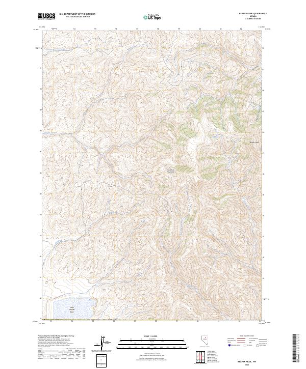
2023 Map of Beaver Peak
USGS Topo · Published 2023About this map
Tuscarora Mountains dominate this high-desert landscape in northern Elko County, where the terrain is defined by a series of steep drainages and prominent summits. The 2023 survey identifies Beaver Peak as a primary landmark on the eastern ridge, overlooking the deeply incised Barber Canyon and Coyote Creek. This area of Nevada is characterized by complex hydrology, with systems like Boulder Creek and Bell Creek carving through the range, while the southwestern corner opens into the Little Boulder Basin. A notable cultural inclusion is the Shoshone label Davu'tsi Naokwaide in the northwest, reflecting the indigenous heritage of the Great Basin. The network of canyons including Toro Canyon and the presence of numerous small springs and ephemeral creeks suggest a landscape shaped by seasonal water movement and high-elevation grazing interests within the public land survey system.
Find a feature on this map
16 named features on this map. Tap any name to fly to it.
Don’t see what you’re looking for? This feature index may not catch every label — zoom into the map to look around manually.
Map Details
Editions of this 2023 Beaver Peak Map
This is the sole edition of this map. No revisions or reprints were ever made.
Other maps of this area

1955 · McDermitt
USGS Topo · 1:250,000

1955 · Winnemucca
USGS Topo · 1:250,000

1958 · Winnemucca
USGS Topo · 1:250,000

1959 · McDermitt
USGS Topo · 1:250,000

1962 · Winnemucca
USGS Topo · 1:250,000

1968 · Rodeo Creek NE
USGS Topo · 1:24,000

1968 · Swales Mountain NW
USGS Topo · 1:24,000

1968 · Rodeo Creek NW
USGS Topo · 1:24,000

1970 · Sugarloaf Butte
USGS Topo · 1:24,000

1970 · Lake Mountain
USGS Topo · 1:24,000