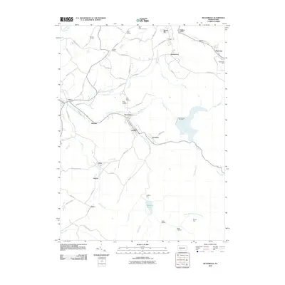
2010 Map of Beaverdale
USGS Topo · Published 2010About this map
Beaverdale and Lloydell serve as central nodes in this early 21st-century landscape, positioned along the South Fork Little Conemaugh River. The map reveals a dense concentration of local heritage sites, including Saint Marys Cemetery, Saint Josephs Cemetery, and the Buckhorn Grange, reflecting the long-established social fabric of these Cambria County communities. The terrain transitions from these settled valleys toward high points like Round Top and the natural depressions of Coon Hollow and Bear Wallow to the south.
Find a feature on this map
73 named features on this map. Tap any name to fly to it.
Don’t see what you’re looking for? This feature index may not catch every label — zoom into the map to look around manually.
Map Details
Editions of this 2010 Beaverdale Map
This is the sole edition of this map. No revisions or reprints were ever made.
Other maps of this area

1902 · Ebensburg
USGS Topo · 1:62,500

1904 · Ebensburg
USGS Topo · 1:62,500

1904 · Johnstown
USGS Topo · 1:62,500

1907 · Johnstown
USGS Topo · 1:62,500

1908 · Bedford
USGS Topo · 1:62,500

1910 · Bedford
USGS Topo · 1:62,500

1914 · Windber
USGS Topo · 1:62,500

1916 · Windber
USGS Topo · 1:62,500

1944 · Windber
USGS Topo · 1:62,500

1953 · Pittsburgh
USGS Topo · 1:250,000
Featured Places
- Pavia Township, PA
- Martindale, Portage Township
- Puritan, Portage Township
- Beaverdale, Summerhill Township
- Allendale, Adams Township