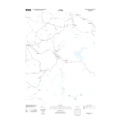
2013 Map of Beaverdale
USGS Topo · Published 2013About this map
Beaverdale and the adjacent settlement of Lloydell form a central hub of activity along the S Fork Little Conemaugh River in this 2013 survey. The landscape is defined by its deep connection to the water network, where the Beaverdale Reservoir and Portage Reservoir sit among the higher elevations. Small, distinct communities like Puritan, Onnalinda, and Dunlo are connected by a network of local roads including Fieldstone Ave and Frankstown Rd. The settlement pattern suggests a history of compact villages established near water sources and along the valley floors, with terrain features such as Coon Hollow and Bear Wallow marking the less developed southern reaches. Further west, Sidman and Allendale sit near the river's path as it winds through the county, while more isolated settlements like Fiddlers Green and Krayn highlight the rural character of the outlying township lands.
Find a feature on this map
95 named features on this map. Tap any name to fly to it.
Don’t see what you’re looking for? This feature index may not catch every label — zoom into the map to look around manually.
Map Details
Editions of this 2013 Beaverdale Map
This is the sole edition of this map. No revisions or reprints were ever made.
Other maps of this area

1902 · Ebensburg
USGS Topo · 1:62,500

1904 · Ebensburg
USGS Topo · 1:62,500

1904 · Johnstown
USGS Topo · 1:62,500

1907 · Johnstown
USGS Topo · 1:62,500

1908 · Bedford
USGS Topo · 1:62,500

1910 · Bedford
USGS Topo · 1:62,500

1914 · Windber
USGS Topo · 1:62,500

1916 · Windber
USGS Topo · 1:62,500

1944 · Windber
USGS Topo · 1:62,500

1953 · Pittsburgh
USGS Topo · 1:250,000
Featured Places
- Pavia Township, PA
- Martindale, Portage Township
- Puritan, Portage Township
- Beaverdale, Summerhill Township
- Allendale, Adams Township