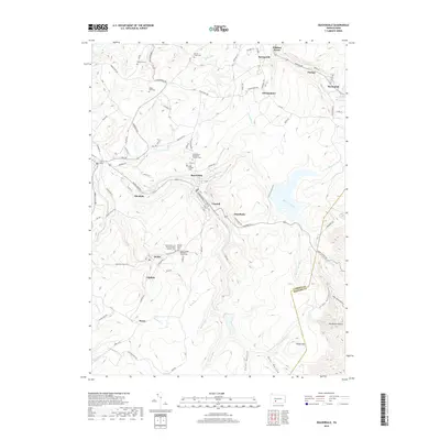
2019 Map of Beaverdale
USGS Topo · Published 2019About this map
The S Fork Little Conemaugh River carves a deep path through this section of the Allegheny Plateau, anchoring a string of historic coal and industrial settlements including Beaverdale, Lloydell, and Dunlo. This 2019 survey illustrates the dense concentration of religious and community landmarks that defined these mountain towns, specifically noted through sites like Saint Mary's Byzantine Catholic Cem and Saints Peter and Paul Byzantine Catholic Cem.
Find a feature on this map
96 named features on this map. Tap any name to fly to it.
Don’t see what you’re looking for? This feature index may not catch every label — zoom into the map to look around manually.
Map Details
Editions of this 2019 Beaverdale Map
This is the sole edition of this map. No revisions or reprints were ever made.
Other maps of this area

1902 · Ebensburg
USGS Topo · 1:62,500

1904 · Ebensburg
USGS Topo · 1:62,500

1904 · Johnstown
USGS Topo · 1:62,500

1907 · Johnstown
USGS Topo · 1:62,500

1908 · Bedford
USGS Topo · 1:62,500

1910 · Bedford
USGS Topo · 1:62,500

1914 · Windber
USGS Topo · 1:62,500

1916 · Windber
USGS Topo · 1:62,500

1944 · Windber
USGS Topo · 1:62,500

1953 · Pittsburgh
USGS Topo · 1:250,000
Featured Places
- Pavia Township, PA
- Martindale, Portage Township
- Puritan, Portage Township
- Beaverdale, Summerhill Township
- Allendale, Adams Township