2023 Map of Beaverdale
USGS Topo · Published 2023About this map
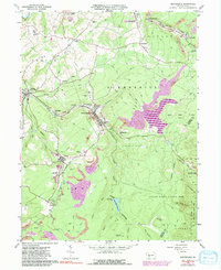
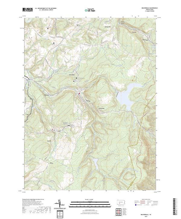
The South Fork Little Conemaugh River and its tributaries carve through the heart of this Cambria County landscape, defining the industrial and residential corridors of Beaverdale and Lloydell. This modern survey illustrates how closely these communities were built along the river and the Norfolk Southern rail lines that served the region's historic mining and timber industries. Further west, the settlements of Dunlo and Llanfair sit atop the high ground above the drainage of Sulphur Creek, appearing as compact residential grids surrounded by the dense woodlands of Gallitzin State Forest.
Find a feature on this map
42 named features on this map. Tap any name to fly to it.
Don’t see what you’re looking for? This feature index may not catch every label — zoom into the map to look around manually.
Map Details
Editions of this 2023 Beaverdale Map
This is the sole edition of this map. No revisions or reprints were ever made.