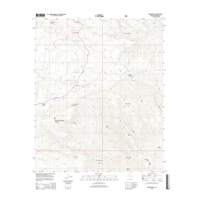
2014 Map of Beaverhead
USGS Topo · Published 2014About this map
Apache National Forest dominates this section of Greenlee County, where the high-altitude topography of the White Mountains is marked by a complex network of canyons and springs. The map documents the high-desert and mountainous transition near Beaverhead, a small settlement situated along the winding route of US Hwy 191. The area is characterized by numerous livestock and wildlife watering sites, including Beaverhead Natural Lake, Duck Corral Tank, and Accident Tank. Resource extraction and road maintenance infrastructure are evident through several sites such as the Hannagan Gravel Pit and the Campbell Blue Borrow Pit Number One. Terrain landmarks like the jagged Devils Washboard, Bell Rock, and the prominent Carlton Vista provide vertical orientation across a landscape carved by Campbell Blue Creek and Foote Creek.
Find a feature on this map
57 named features on this map. Tap any name to fly to it.
Don’t see what you’re looking for? This feature index may not catch every label — zoom into the map to look around manually.
Map Details
Editions of this 2014 Beaverhead Map
This is the sole edition of this map. No revisions or reprints were ever made.
Other maps of this area

1922 · Nutrioso
USGS Topo · 1:125,000

1954 · Clifton
USGS Topo · 1:250,000

1957 · Clifton
USGS Topo · 1:250,000

1958 · Clifton
USGS Topo · 1:250,000

1958 · Alpine
USGS Topo · 1:62,500

1958 · Hannagan Meadow
USGS Topo · 1:62,500

1958 · Big Lake
USGS Topo · 1:62,500

1961 · Blue
USGS Topo · 1:62,500

1962 · Clifton
USGS Topo · 1:250,000
1981 · Nutrioso
USGS Topo · 1:100,000