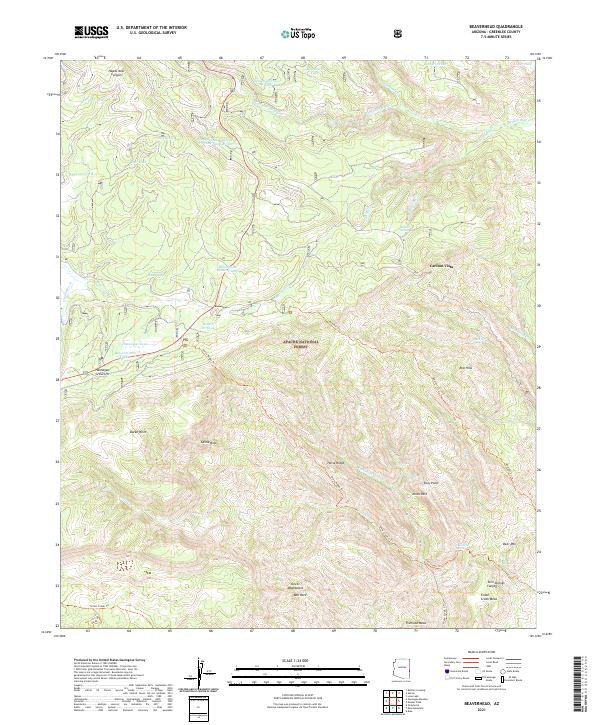
2021 Map of Beaverhead
USGS Topo · Published 2021About this map
The Apache National Forest dominates this section of Greenlee County, characterized by a complex network of high-elevation plateaus and deep drainage canyons. Beaverhead serves as a central landmark in this high-country landscape, situated near the distinctive Beaverhead Natural Lake. The terrain is defined by prominent geological features such as Fishhook Mesa, Foote Creek Mesa, and the striking Castle Rock. These elevations are carved by numerous watercourses, including Campbell Blue Cr and Hannagan Cr, which feed into various stock tanks like Accident Tank and Snag Tank.
Find a feature on this map
54 named features on this map. Tap any name to fly to it.
Don’t see what you’re looking for? This feature index may not catch every label — zoom into the map to look around manually.
Map Details
Editions of this 2021 Beaverhead Map
This is the sole edition of this map. No revisions or reprints were ever made.
Other maps of this area

1922 · Nutrioso
USGS Topo · 1:125,000

1954 · Clifton
USGS Topo · 1:250,000

1957 · Clifton
USGS Topo · 1:250,000

1958 · Clifton
USGS Topo · 1:250,000

1958 · Alpine
USGS Topo · 1:62,500

1958 · Hannagan Meadow
USGS Topo · 1:62,500

1958 · Big Lake
USGS Topo · 1:62,500

1961 · Blue
USGS Topo · 1:62,500

1962 · Clifton
USGS Topo · 1:250,000
1981 · Nutrioso
USGS Topo · 1:100,000