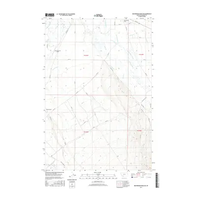
2017 Map of Beaverhead Rock NE
USGS Topo · Published 2017About this map
The Beaverhead River and Ruby River define this Madison County landscape, illustrating a complex network of water management in southwestern Montana. The terrain is characterized by numerous historic irrigation channels such as the Mule Shoe Ditch, Lewis-Jenkins Ditch, and Sarge Hall Ditch, which redirect water across the valley floor to support local agriculture. The Beaverhead River Bridge serves as a critical crossing point for local transit, while the presence of the East Bench Canal at the southern edge of the survey indicates the scale of large-project water engineering in the region.
Find a feature on this map
50 named features on this map. Tap any name to fly to it.
Don’t see what you’re looking for? This feature index may not catch every label — zoom into the map to look around manually.
Map Details
Editions of this 2017 Beaverhead Rock NE Map
This is the sole edition of this map. No revisions or reprints were ever made.
Other maps of this area

1893 · Dillon
USGS Topo · 1:250,000

1955 · Dillon
USGS Topo · 1:250,000

1957 · Dillon
USGS Topo · 1:250,000

1958 · Dillon
USGS Topo · 1:250,000

1960 · Twin Bridges
USGS Topo · 1:62,500

1960 · Waterloo
USGS Topo · 1:62,500

1961 · Beaverhead Rock SE
USGS Topo · 1:24,000

1962 · Dillon
USGS Topo · 1:250,000
1962 · Beaverhead Rock
USGS Topo · 1:24,000
1962 · Beaverhead Rock SW
USGS Topo · 1:24,000