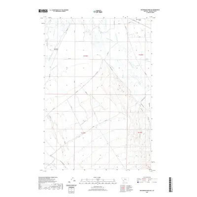
2020 Map of Beaverhead Rock NE
USGS Topo · Published 2020About this map
The Beaverhead River and Ruby River converge in this section of Madison County, defining a landscape dominated by complex irrigation systems and ranching infrastructure. Numerous named waterways, including the Mule Shoe Ditch, Seyler-Tash Ditch, and Lewis-Jenkins Ditch, crisscross the basin floor, illustrating the historical engineering required to manage water in this high-altitude valley. The East Bench Canal runs through the southwestern reaches, while the Beaverhead River Bridge provides a key crossing point for local transit. Higher elevations are marked by the Coyote Crst and the drainage of Wet Georgia Gulch, offering a distinct contrast to the active agricultural zones of the Oxbow Ranch and surrounding parcels. Rural roads like Cutoff Rd and Ruby River Dr connect the scattered homesteads and property lines established during the early years of Montana's settlement.
Find a feature on this map
48 named features on this map. Tap any name to fly to it.
Don’t see what you’re looking for? This feature index may not catch every label — zoom into the map to look around manually.
Map Details
Editions of this 2020 Beaverhead Rock NE Map
This is the sole edition of this map. No revisions or reprints were ever made.
Other maps of this area

1893 · Dillon
USGS Topo · 1:250,000

1955 · Dillon
USGS Topo · 1:250,000

1957 · Dillon
USGS Topo · 1:250,000

1958 · Dillon
USGS Topo · 1:250,000

1960 · Twin Bridges
USGS Topo · 1:62,500

1960 · Waterloo
USGS Topo · 1:62,500

1961 · Beaverhead Rock SE
USGS Topo · 1:24,000

1962 · Dillon
USGS Topo · 1:250,000
1962 · Beaverhead Rock
USGS Topo · 1:24,000
1962 · Beaverhead Rock SW
USGS Topo · 1:24,000