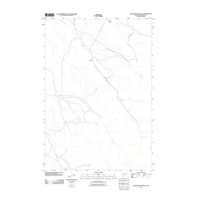
2011 Map of Beaverhead Rock SE
USGS Topo · Published 2011About this map
McHessor Creek and its surrounding drainage basin define this portion of Madison County, where the landscape is shaped by the convergence of several significant watercourses. The map documents a rural environment centered on high-country agriculture and water management, evidenced by the Mad Chant Dam and established landholdings like the Christensen Ranch and Metzel Ranch. The terrain varies from the level reaches along Trout Creek to the more dissected topography near Spring Canyon and Mine Gulch.
Find a feature on this map
13 named features on this map. Tap any name to fly to it.
Don’t see what you’re looking for? This feature index may not catch every label — zoom into the map to look around manually.
Map Details
Editions of this 2011 Beaverhead Rock SE Map
This is the sole edition of this map. No revisions or reprints were ever made.
Other maps of this area

1893 · Dillon
USGS Topo · 1:250,000

1955 · Dillon
USGS Topo · 1:250,000

1957 · Dillon
USGS Topo · 1:250,000

1958 · Dillon
USGS Topo · 1:250,000

1961 · Mine Gulch
USGS Topo · 1:24,000

1961 · Christensen Ranch
USGS Topo · 1:24,000

1961 · Beaverhead Rock SE
USGS Topo · 1:24,000

1962 · Dillon
USGS Topo · 1:250,000
1962 · Beaverhead Rock
USGS Topo · 1:24,000
1962 · Beaverhead Rock SW
USGS Topo · 1:24,000