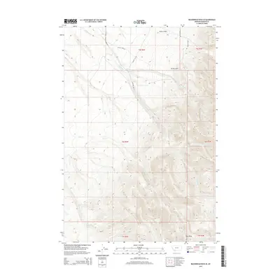
2014 Map of Beaverhead Rock SE
USGS Topo · Published 2014About this map
The Ruby Range dominates the southeastern quadrant of this terrain study, where sharp elevation changes define the landscape. This area of Madison County is carved by a network of seasonal and perennial waterways, most notably McHessor Cr and Big Dry Cr, which drain from the higher elevations. The infrastructure is primarily composed of rural connectors such as Mchessor Creek Rd and Bennett Hill Rd, tracing the low-lying paths between ridges.
Find a feature on this map
20 named features on this map. Tap any name to fly to it.
Don’t see what you’re looking for? This feature index may not catch every label — zoom into the map to look around manually.
Map Details
Editions of this 2014 Beaverhead Rock SE Map
This is the sole edition of this map. No revisions or reprints were ever made.
Other maps of this area

1893 · Dillon
USGS Topo · 1:250,000

1955 · Dillon
USGS Topo · 1:250,000

1957 · Dillon
USGS Topo · 1:250,000

1958 · Dillon
USGS Topo · 1:250,000

1961 · Mine Gulch
USGS Topo · 1:24,000

1961 · Christensen Ranch
USGS Topo · 1:24,000

1961 · Beaverhead Rock SE
USGS Topo · 1:24,000

1962 · Dillon
USGS Topo · 1:250,000
1962 · Beaverhead Rock
USGS Topo · 1:24,000
1962 · Beaverhead Rock SW
USGS Topo · 1:24,000