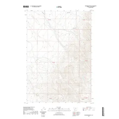
2020 Map of Beaverhead Rock SE
USGS Topo · Published 2020About this map
The rugged foothills of the Ruby Range define this 2020 topographic survey of Madison County, where steep drainages and isolated agricultural holdings mark the landscape. Settled ranching operations such as Metzel Ranch and Christensen Ranch sit amidst a complex network of seasonal and perennial waterways, including McHessor Cr and Trout Cr. The terrain is characterized by sharp elevation changes through Laurin Canyon and the prominent Big Dry Gulch, reflecting the high-elevation ranching environment of south-central Montana.
Find a feature on this map
19 named features on this map. Tap any name to fly to it.
Don’t see what you’re looking for? This feature index may not catch every label — zoom into the map to look around manually.
Map Details
Editions of this 2020 Beaverhead Rock SE Map
This is the sole edition of this map. No revisions or reprints were ever made.
Other maps of this area

1893 · Dillon
USGS Topo · 1:250,000

1955 · Dillon
USGS Topo · 1:250,000

1957 · Dillon
USGS Topo · 1:250,000

1958 · Dillon
USGS Topo · 1:250,000

1961 · Mine Gulch
USGS Topo · 1:24,000

1961 · Christensen Ranch
USGS Topo · 1:24,000

1961 · Beaverhead Rock SE
USGS Topo · 1:24,000

1962 · Dillon
USGS Topo · 1:250,000
1962 · Beaverhead Rock
USGS Topo · 1:24,000
1962 · Beaverhead Rock SW
USGS Topo · 1:24,000