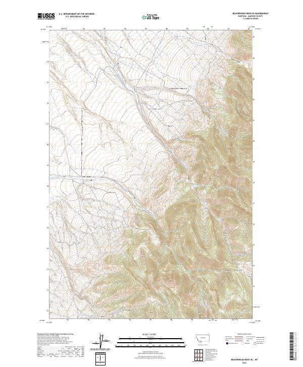
2024 Map of Beaverhead Rock SE
USGS Topo · Published 2024About this map
Ruby Range dominates the eastern landscape of this quadrangle, defining a high-elevation environment where seasonal drainages carve through the terrain. The hydrological network is established by McHessor Creek and Big Dry Creek, which orient the drainage patterns across the central sections. Human presence is sparse, marked primarily by the foundational grid of the Public Land Survey System and the access provided by McHessor Creek Rd in the north.
Find a feature on this map
13 named features on this map. Tap any name to fly to it.
Don’t see what you’re looking for? This feature index may not catch every label — zoom into the map to look around manually.
Map Details
Editions of this 2024 Beaverhead Rock SE Map
This is the sole edition of this map. No revisions or reprints were ever made.
Other maps of this area

1893 · Dillon
USGS Topo · 1:250,000

1955 · Dillon
USGS Topo · 1:250,000

1957 · Dillon
USGS Topo · 1:250,000

1958 · Dillon
USGS Topo · 1:250,000

1961 · Mine Gulch
USGS Topo · 1:24,000

1961 · Christensen Ranch
USGS Topo · 1:24,000

1961 · Beaverhead Rock SE
USGS Topo · 1:24,000

1962 · Dillon
USGS Topo · 1:250,000
1962 · Beaverhead Rock
USGS Topo · 1:24,000
1962 · Beaverhead Rock SW
USGS Topo · 1:24,000