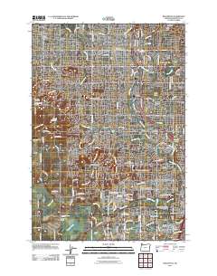
2011 Map of Beaverton
USGS Topo · Published 2011About this map
Beaverton and Tigard anchor this detailed 2011 survey, showing the complex suburban and riparian landscape of the Portland periphery. The map traces the dense network of roads and residential growth stretching from Aloha and Cedar Hills south toward Tualatin. The Tualatin River meanders across the southern portion of the sheet, joined by Chicken Creek and Rock Creek near the Onion Flat terrain.
Find a feature on this map
127 named features on this map. Tap any name to fly to it.
Don’t see what you’re looking for? This feature index may not catch every label — zoom into the map to look around manually.
Map Details
Editions of this 2011 Beaverton Map
This is the sole edition of this map. No revisions or reprints were ever made.
Other maps of this area

1897 · Portland
USGS Topo · 1:62,500

1905 · Portland
USGS Topo · 1:62,500

1914 · Oregon City
USGS Topo · 1:62,500

1915 · Hillsboro
USGS Topo · 1:62,500

1916 · Tualatin
USGS Topo · 1:62,500

1918 · Hillsboro
USGS Topo · 1:62,500

1939 · Oregon City
USGS Topo · 1:62,500

1939 · Tualatin
USGS Topo · 1:62,500

1940 · Tualatin
USGS Topo · 1:62,500

1940 · Hillsboro
USGS Topo · 1:62,500