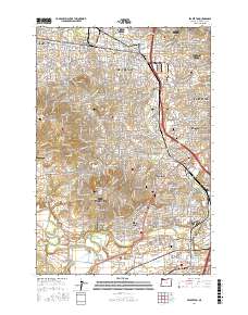
2017 Map of Beaverton
USGS Topo · Published 2017About this map
The Tualatin Valley serves as the backdrop for this detailed topographical record of suburban development and agricultural transition in Washington County. Centered on the city of Beaverton, the landscape is defined by the elevation of Cooper Mountain and Sexton Mountain to the west, while the eastern edge blends into the Portland metropolitan area. Water systems like the Tualatin River, Fanno Creek, and Beaverton Creek create the drainage patterns that shaped early settlement and modern road networks. For those researching family history, the map includes several significant burial sites, including Patton Cemetery, Crescent Grove Cemetery, and Saint Anthony's Cemetery. Aviation enthusiasts will find small-scale infrastructure such as the Flying K Ranch Airport and Meyer Riverside Airpark, illustrating the area's mix of residential density and remaining open spaces.
Find a feature on this map
208 named features on this map. Tap any name to fly to it.
Don’t see what you’re looking for? This feature index may not catch every label — zoom into the map to look around manually.
Map Details
Editions of this 2017 Beaverton Map
This is the sole edition of this map. No revisions or reprints were ever made.
Other maps of this area

1897 · Portland
USGS Topo · 1:62,500

1905 · Portland
USGS Topo · 1:62,500

1914 · Oregon City
USGS Topo · 1:62,500

1915 · Hillsboro
USGS Topo · 1:62,500

1916 · Tualatin
USGS Topo · 1:62,500

1918 · Hillsboro
USGS Topo · 1:62,500

1939 · Oregon City
USGS Topo · 1:62,500

1939 · Tualatin
USGS Topo · 1:62,500

1940 · Tualatin
USGS Topo · 1:62,500

1940 · Hillsboro
USGS Topo · 1:62,500