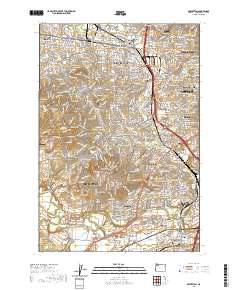
2020 Map of Beaverton
USGS Topo · Published 2020About this map
Beaverton and the southwestern suburbs of Portland appear in high resolution in this modern topographic study. The landscape is defined by its transition from suburban residential grids to the natural contours of Sexton Mtn and Bull Mountain, bordered to the south by the Tualatin River. Transportation networks like SW Scholls Ferry Rd and SW Pacific Dr facilitate movement between established neighborhoods like West Slope, Raleigh Hills, and Garden Home.
Find a feature on this map
70 named features on this map. Tap any name to fly to it.
Don’t see what you’re looking for? This feature index may not catch every label — zoom into the map to look around manually.
Map Details
Editions of this 2020 Beaverton Map
This is the sole edition of this map. No revisions or reprints were ever made.
Other maps of this area

1897 · Portland
USGS Topo · 1:62,500

1905 · Portland
USGS Topo · 1:62,500

1914 · Oregon City
USGS Topo · 1:62,500

1915 · Hillsboro
USGS Topo · 1:62,500

1916 · Tualatin
USGS Topo · 1:62,500

1918 · Hillsboro
USGS Topo · 1:62,500

1939 · Oregon City
USGS Topo · 1:62,500

1939 · Tualatin
USGS Topo · 1:62,500

1940 · Tualatin
USGS Topo · 1:62,500

1940 · Hillsboro
USGS Topo · 1:62,500