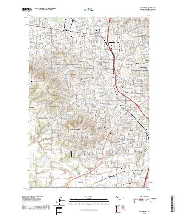
2024 Map of Beaverton
USGS Topo · Published 2024About this map
Beaverton and its surrounding suburbs appear here as a densely developed landscape, characterized by the convergence of several major drainages like Fanno Creek and Beaverton Creek. The map documents the intricate residential and commercial growth patterns of the 2020s, showing how neighborhoods such as Metzger, Progress, and West Slope have filled the space between the city centers. Significant natural landmarks like Bull Mountain and Sexton Mountain rise above the suburban sprawl, while the Tualatin River National Wildlife Refuge preserves a massive wetland corridor along the Tualatin River at the southern edge.
Find a feature on this map
55 named features on this map. Tap any name to fly to it.
Don’t see what you’re looking for? This feature index may not catch every label — zoom into the map to look around manually.
Map Details
Editions of this 2024 Beaverton Map
This is the sole edition of this map. No revisions or reprints were ever made.
Other maps of this area

1897 · Portland
USGS Topo · 1:62,500

1905 · Portland
USGS Topo · 1:62,500

1914 · Oregon City
USGS Topo · 1:62,500

1915 · Hillsboro
USGS Topo · 1:62,500

1916 · Tualatin
USGS Topo · 1:62,500

1918 · Hillsboro
USGS Topo · 1:62,500

1939 · Oregon City
USGS Topo · 1:62,500

1939 · Tualatin
USGS Topo · 1:62,500

1940 · Tualatin
USGS Topo · 1:62,500

1940 · Hillsboro
USGS Topo · 1:62,500