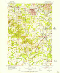
1954 Map of Beaverton
USGS Topo · Published 1956About this map
Beaverton serves as a central hub for transportation and education in this mid-century portrait of Washington County. The Southern Pacific and Oregon Electric railroads converge near the heart of town, while prominent educational institutions like Beaverton High Sch and the St Marys Boys Home anchor the local community. To the south, the landscape transitions from the residential developments of Tigard and Metzger into the more open terrain surrounding Bull Mtn and the winding course of the Tualatin River. The presence of several family-named landmarks and historical sites, including the Robinson Cem and Cooper Mtn Cem, provides significant detail for researchers of the area’s genealogy. From the Portland Golf Club in the northeast to the Onion Flat wetlands in the south, the map documents a period of suburban expansion before the massive growth of the later 20th century.
Find a feature on this map
77 named features on this map. Tap any name to fly to it.
Don’t see what you’re looking for? This feature index may not catch every label — zoom into the map to look around manually.
Map Details
Editions of this 1954 Beaverton Map
This is the sole edition of this map. No revisions or reprints were ever made.
Other maps of this area

1897 · Portland
USGS Topo · 1:62,500

1905 · Portland
USGS Topo · 1:62,500

1914 · Oregon City
USGS Topo · 1:62,500

1915 · Hillsboro
USGS Topo · 1:62,500

1916 · Tualatin
USGS Topo · 1:62,500

1918 · Hillsboro
USGS Topo · 1:62,500

1939 · Oregon City
USGS Topo · 1:62,500

1939 · Tualatin
USGS Topo · 1:62,500

1940 · Tualatin
USGS Topo · 1:62,500

1940 · Hillsboro
USGS Topo · 1:62,500