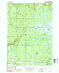
1989 Map of Bechler Falls
USGS Topo · Published 1989About this map
Yellowstone National Park dominates the eastern half of this 1989 survey, where the Bechler River winds through the expansive grass of Bechler Meadows. This corner of the park, along with the adjacent Targhee National Forest and Winegar Hole Wilderness, is defined by its water system. The map documents several significant cascades including Silver Scarf Falls, Dunanda Falls, and the namesake Bechler Falls near the southern boundary. Human infrastructure is limited to the Bechler River Ranger Station, the Cave Falls Campground, and the remote Bartlett site. A network of pack trails provides the only access through this backcountry, crossing Bechler Slough and passing by Lilypad Lake and Robinson Lake. The presence of a Gaging Station and a Borrow Pit near the Idaho-Wyoming border suggests the ongoing management of this protected landscape during the late twentieth century.
Find a feature on this map
30 named features on this map. Tap any name to fly to it.
Don’t see what you’re looking for? This feature index may not catch every label — zoom into the map to look around manually.
Map Details
Editions of this 1989 Bechler Falls Map
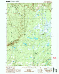
2 editions found
Other maps of this area

1886 · Shoshone
USGS Topo · 1:125,000

1888 · Shoshone
USGS Topo · 1:125,000

1895 · Shoshone
USGS Topo · 1:125,000

1901 · Shoshone
USGS Topo · 1:125,000

1908 · Shoshone
USGS Topo · 1:125,000

1911 · Shoshone
USGS Topo · 1:125,000

1955 · Ashton
USGS Topo · 1:250,000

1956 · Old Faithful
USGS Topo · 1:62,500

1956 · Grassy Lake Reservoir
USGS Topo · 1:62,500

1957 · Warm River Butte
USGS Topo · 1:62,500