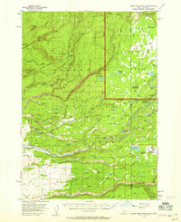
1957 Map of Warm River Butte
USGS Topo · Published 1958About this map
The Targhee National Forest and the southwestern corner of Yellowstone National Park converge in this mid-century topographic study, defined by the hydrological divide of the Falls River. The landscape is a network of high-country meadows and volcanic landmarks like Warm River Butte and Rising Butte. The presence of several isolated ranching outposts, including Howell Ranch and J Y Ranch, suggests the late-stage resilience of high-elevation livestock operations in eastern Idaho.
Find a feature on this map
79 named features on this map. Tap any name to fly to it.
Don’t see what you’re looking for? This feature index may not catch every label — zoom into the map to look around manually.
Map Details
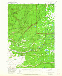
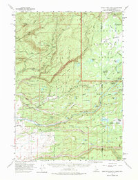
Editions of this 1957 Warm River Butte Map
3 editions found
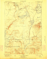
Other maps of this area

1886 · Shoshone
USGS Topo · 1:125,000

1888 · Shoshone
USGS Topo · 1:125,000

1895 · Shoshone
USGS Topo · 1:125,000

1899 · Grand Teton
USGS Topo · 1:125,000

1901 · Shoshone
USGS Topo · 1:125,000

1901 · Grand Teton
USGS Topo · 1:125,000

1908 · Shoshone
USGS Topo · 1:125,000
1911 · Shoshone
USGS Topo · 1:125,000

1955 · Ashton
USGS Topo · 1:250,000

1955 · Driggs
USGS Topo · 1:250,000